
|
|
|
|
| Terrain | |
|
Home of SRTM.ORG Overview |
|
|
Overview In 1999, Position Integrity was chosen as the terrain database providers for the NASA-Langley Aviation Safety Program (ASP). Under a team effort entitled Low Cost Synthetic Vision Capability for General Aviation, we are providing a global terrain database for use in the next generation 3D perspective glass cockpit display system. The team, which is headed up by Research Triangle Institute for Aerospace Technology and includes several prominent industry members, will begin flight testing our innovations early in 2001.
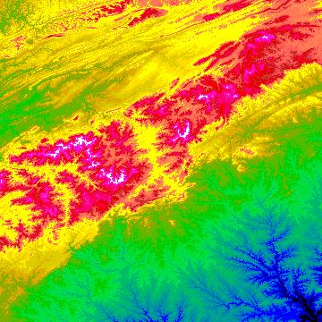
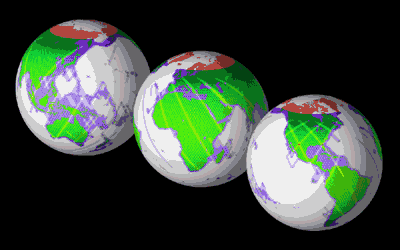
In addition to our work for NASA-Langley, we have been collaborating with the NASA/Jet Propulsion Laboratory in Pasadena for the last seven years on advanced terrain graphics research. JPL's Shuttle Radar Topography Mission (SRTM), was launched on the Shuttle Endeavour STS-99 manifest and mapped the earth in eleven days from February 11-22, 2000. The SRTM radar, with its long wavelength, was able to penetrate clouds as well providing its own illumination, making measurements independent of daylight. One scientific threshold which was surpassed this year is the proof that single-pass, multi-frequency, multi-polarization radar holography is now a reality! From the 222 hours of continuous mapping, there are some 12 terabytes of raw data in the form of 3D "radar holograms" to process. The focus now shifts from the Shuttle flight to the ground data processing at JPL in Pasadena. SRTM has collected data over most of the land surfaces that lay between 60 degrees north latitude and 54 degrees south latitude. That's about 80% of all the land on the Earth. SRTM project scientist Dr. Michael Kobrick (from NASA/JPL) notes that Endeavour mapped an incredible 100,000 square kilometers every minute, and that after only three days of flight, the mission tripled the world's supply of digital terrain elevation data. The low-resolution images processed so far show many topographic features that until now have been difficult to detect on the best maps in existence today. After mission completion, JPL began focusing on ground data processing activities for the equatorial regions of the earth, for which our terrain knowledge is the sparsest. The attached images show the final coverage map and globes from the SRTM mission. In total 119.05 million square kilometers were mapped with at least one interferometric pass, which translates to 99.958% of the goal for the mission. In addition 112.66 million square kilometers were mapped with at least two passes, and many areas in the northern latitudes were covered four or five times. (The number of passes over a sight correlates with vertical height accuracy.)
Position Integrity is assisting in the ground data processing and has the government contract to define and promulgate the next generation graphics data format, called GeoTIFF 2.0. One of the hallmarks of the new data from the shuttle is that JPL will process multiple resolutions and products from any given geographic area. Before GeoTIFF 2.0, each dataset would have to be in its own file and displayed separately in a viewing application. With version 2.0 we will be able to combine terrain at several resolutions along with shaded relief and other images of the same area in one file as well as dynamiclly link to datasets across the Internet. Our free aeronautical moving map application, Digital Aviator will then efficiently and automatically zoom or pan through any of the "layers" while keeping perfect control over knowledge of the geography (especially the latitude, longitude and altitude of every pixel). GeoTIFF 2.0 allows C- and X-band multi-resolution terrain data to co-exist along with radar backscatter, 3D anaglyphs, land use classification, Landsat 7 multi-spectral imagery and NIMA cartographic datasets all within the same file structure. With GeoTIFF 2.0 a user will have access to all these multi-scaled, nested, tiled, gridded and compressed images for a geographic region within a single file. Over the next year we will begin to release prototype SRTM terrain and imagery products in GeoTIFF 2.0 format. Since the SRTM derivative products will be one of the most valuable GIS collections to come from the scientific community in many decades, it is appropriate that Position Integrity GeoTIFF 2.0 technology help herald its public release. For more information on our terrain initiatives, please contact us by telephone or email, or visit the NASA SRTM Home Page. |
|
| Copyright © 1993-2026 Position Integrity, LLC |
