Overview
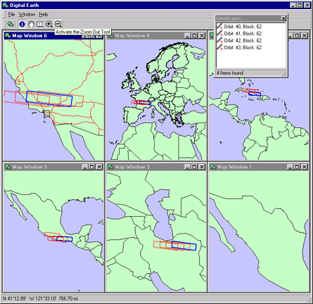
The Digital Earth is a 32-bit Windows application
developed for the NASA Jet Propulsion Laboratory in
Pasadena, California. It allows
scientists to view and analyze geographic data sets of
virtually any type (raster, vector, etc). It also
incorporates advanced spatial query capabilities to
provide seamless integration with the JPL MISR database,
a repository of satellite aerial photography.
Download and Support
The application is only available to JPL personnel. The setup
program is password protected.
Technical support is provided through email.
You may also send comments and suggestions through this channel. All
messages will be acknowledged when they are received.
Updates to the application will be posted as
required.
To obtain the Digital Earth software, or for more information about it
and other software applications or related services, please
contact us by telephone or email.