 Digital Mariner |
|
|
Overview | Details | Availability |
|
|
Overview
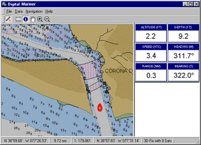
Details Our marine navigation database is comprised of advanced datasets currently being produced and maintained by the United States Military and other participating military organizations around the world. Our marine data products are derived from these datasets and specially formatted for use with Digital Mariner. These advanced datasets offer mariners the ultimate in situational awareness: the look-and-feel of raster charts, with infinite zoom and seamless worldwide coverage found only in vector products. The end result is truly a technological advancement over the marine data products currently available today. For clients with an investment in older raster-based marine charts, the Digital Mariner offers an import facility that can be used with Maptech and SoftChart products. The Digital Mariner's layering technology allows advanced vector datasets to be overlaid on legacy raster charts and imagery for the ultimate in two-dimensional marine situational awareness.
Availability If you are a defense contractor with an active security clearance, you may obtain a copy of the Digital Mariner by contacting us via email or telephone. |
|
| Copyright © 1993-2026 Position Integrity, LLC |